
 3
3 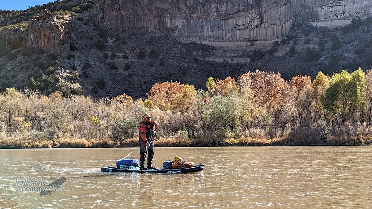
Fall colors were still clinging to the trees in mid-November along the Rio Grande in New Mexico.
Last month I jumped at the last-minute opportunity to join an overnight paddle trip down a “local” run I’ve not done before. It all started with a canceled trip the week prior.
When strong winds kept pushing my originally-planned paddle trip back farther and farther, I had come to the realization that it just wasn’t going to happen this time around for me. But a few short minutes later I was booked for a totally different trip! Some members of my local paddling club were putting together an overnight trip on the Rio Grande through White Rock Canyon near Santa Fe, New Mexico, and I happened to see the trip announcement on our Facebook group. This particular trip has been on my “to-do list” for quite a while, so of course I signed up right away. One of the things I love most about paddling is being able to explore new areas, even if they are close to home.
White Rock Canyon
White Rock Canyon is a 20 mile section of the Rio Grande that borders Santa Fe National Forest on the East bank, and Bandelier National Monument on the West bank. The 1000’ deep canyon was carved by the Rio Grande through layers of dark volcanic basalt and lighter layers of volcanic ash, tuff, and pumice. The nearby Valles Caldera (also a National Preserve) is the ancient origin of this volcanic field. I’m not a geologist, so I won’t try to delve too deeply into that side of the area, but if you are interested in learning more about it, the New Mexico Museum of Natural History & Science has an excellent write up on the geology of the area.
Even though it is between Santa Fe and Los Alamos, the rugged terrain of the area keeps visitation relatively low and the current population to nearly zero. However it wasn’t always that way. Petroglyphs and pictographs created by the native puebloan peoples are found in the hundreds throughout the canyon. The canyon is home to a few different endangered plants, and is absolutely teeming with wildlife. You can also find natural springs, waterfalls, and all sorts of other geological features throughout the area.
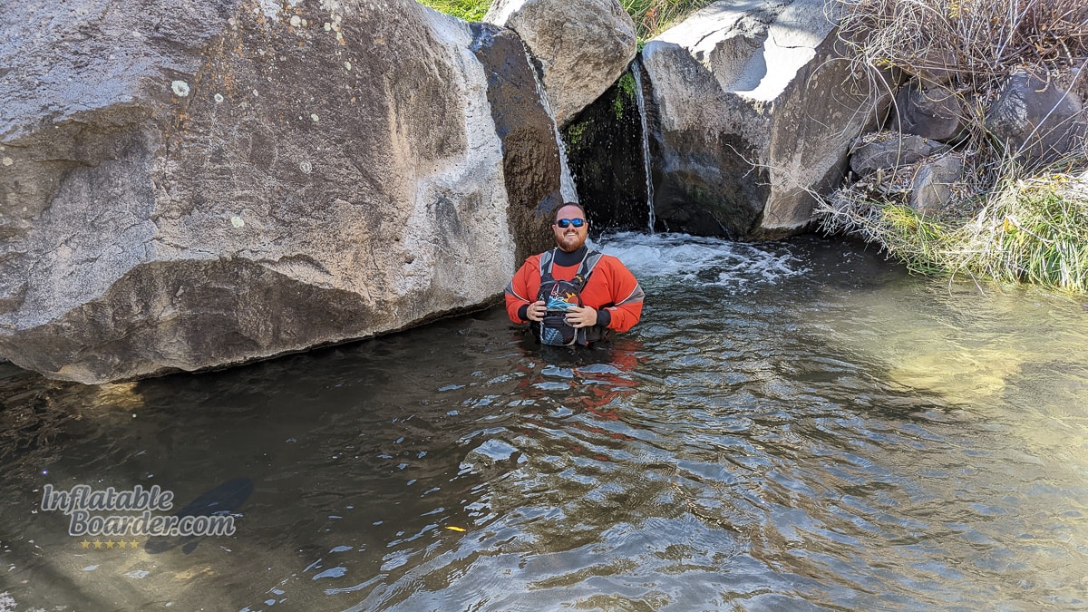
Pajarito Cold Springs is a natural spring with a year-round temperature of about 65 F.
Paddling this 20-mile stretch of river is relatively straight forward, but does have a couple of complicating factors.
First: there’s the campsite uncertainty. We knew for sure there would be a good campsite about 14 miles down river from where we started. We were hoping to find a clearing along the river with decent access, or a large-enough sand bar in the river, somewhere closer to the halfway mark. Because of the terrain and variable height of the river, the actual number and condition of campsites changes throughout the year.
Second: The first 7 miles of river are whitewater with lots of Class I and II- splashy rapids, a solid Class II (Water Canyon), and a Class III (Ancho Canyon) rapid around mile 6.
Getting Ready
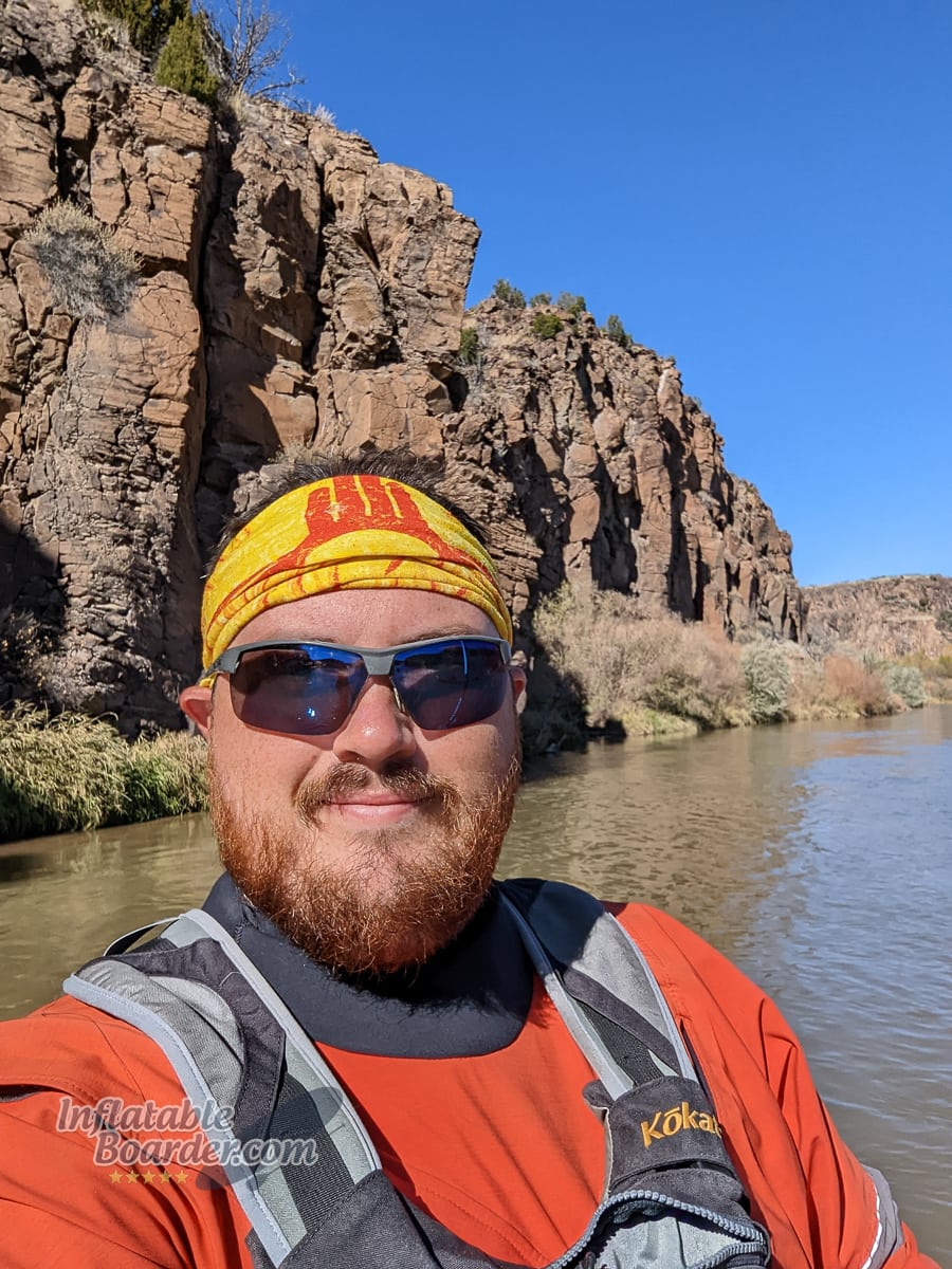
November weather in New Mexico can be anywhere from 75° F and sunny to 35° F and raining, and of course the winds could be just as variable, so checking the weather was vital in preparing for this trip. Luckily the weather forecast was calm, sunny days with highs in the 50’s and lows in the 20’s. However the water temperature in the Rio Grande was already hitting the upper 40’s. I always dress for the swim, and cold water is particularly dangerous, so I knew I’d be wearing my dry suit with a few warm layers under it.
Along with my dry suit, I’d need to bring everything I needed for camping in 20° F temps with me on my paddleboard. I had my camp clothes, backpacking stove and meals, backpacking tent, and – since I’m a Desert Rat who doesn’t own a “warm” sleeping bag anymore – both a down sleeping bag and down backpacking quilt.
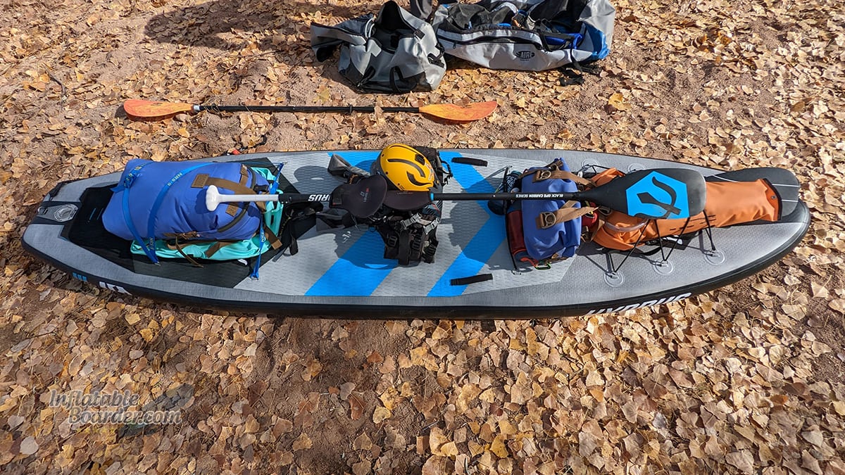
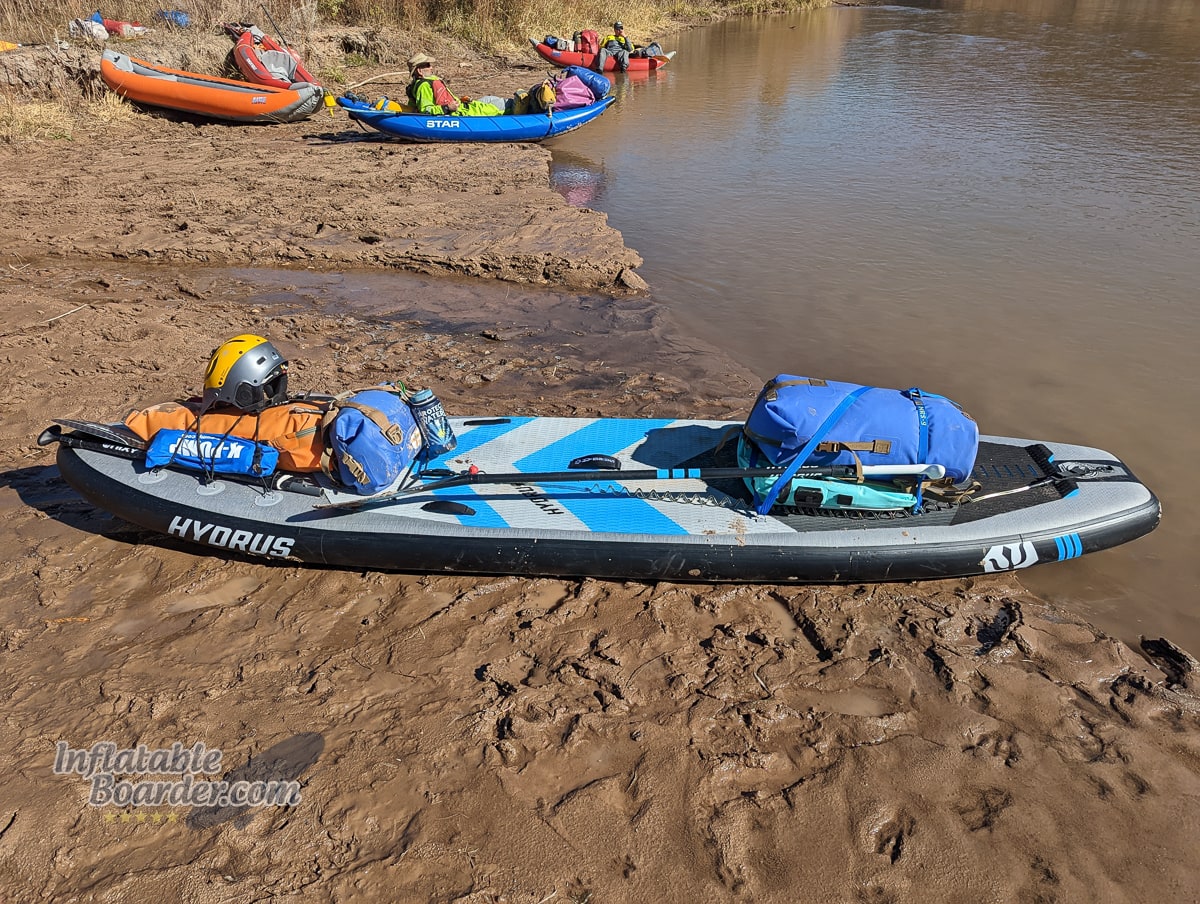
Everything I’d need to stay cozy for the weekend packed and ready to hit the river!
I packed my camping essentials (tent, sleeping kit, kitchen/food) into my Watershed Animas dry bag on the rear of the board, and my clothing into my Watershed Futa dry bag on the front of the board. I try to stay comfortable even when packing light, so I brought a Bote Aero SUP Paddle Seat to use as a camp chair, a 3-hour fire log for the campfire, and another dry bag (Watershed Ocoee) for some river snacks, electronics, and emergency equipment. I also brought a spare paddle, a few water bottles, my whitewater helmet, quick-release leash, and some neoprene mittens to use if my hands got cold while paddling.
All of that fit easily on the Hydrus Joyride XL iSUP I used for this trip. I chose the Joyride XL for a couple of reasons.
- I wanted plenty of room for my camping gear
- I wanted lots of stability for the first half of the trip
- I wanted more nose rocker for the larger rapids
- I wanted good efficiency for the second half of the trip
The Joyride XL is an all-around iSUP, but it’s designed to work well on rivers up to Class III rapids for experienced paddlers. It’s not the whitewater machine that the Hydrus Axis 98 is, but the Joyride XL is a better platform for carrying more equipment and paddling easier on the last ⅔ of the trip that were flat water. I also knew that the extra-stiff construction and high-pressure capacity of the Joyride XL would make carrying my camping equipment and dealing with choppy conditions better than a lightweight paddleboard. Hydrus also ships their inflatable SUPs with a variety of different fins, and I knew the 4.5” gummy fin that came with the Joyride XL would be perfect for this low-water trip.
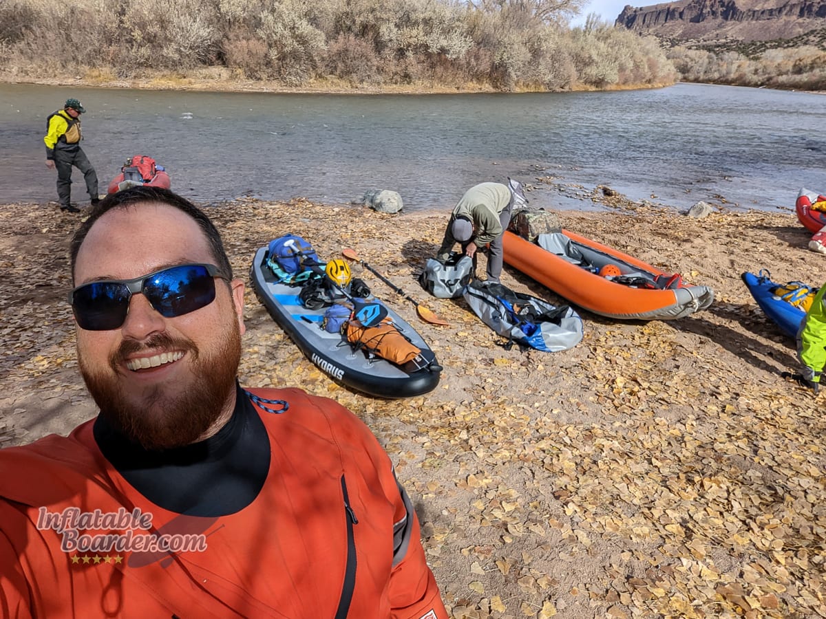
I was the only paddleboarder on this trip. The rest of the crew used inflatable kayaks.
Setting Off
A common question about river paddling is “how do I get back to my car?” Well, there are a few different ways to do it. You can have someone pick you up at the end of your trip. The problem with this is it requires good timing to not keep your ride waiting, and things do come up even on short river trips. The other way is to run a shuttle before you paddle. We met at our takeout point, loaded into the fewest number of vehicles possible, then went to the put in. Normally one of us would then drive the others back to get their vehicles, however we had two people that volunteered to drive those shuttles for us, so they went home after we launched.
Getting ready at the put in was straight forward. We inflated our boats, loaded our gear, and then got dressed in our dry suits. Having everything ready to go before you get to the put in is important to keeping the trip on time. We did have one kayaker who took a significantly longer time than the rest to get ready, so we didn’t hit the water until about 11:15am – about 30 minutes later than we planned.
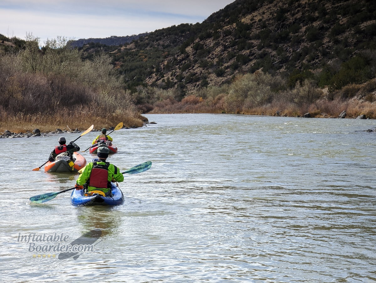
Heading around the first bend of the trip.
The Rio Grande through White Rock Canyon starts as a relatively calm, but swift flowing river over a mixed stone and sand river bed. The first few miles had some splashy little waves and a few shallow spots (one of which was shallow enough that I had to hop off the board for a few feet), but was mostly uneventful. A few sharper turns in the river made some larger wave trains with 1-2 foot tall waves, but nothing major.
About two miles into the trip we stopped for a few minutes at Pajarito Springs. This is a natural cold spring with a small waterfall and pool that is a five minute walk from the river (pictured above). It is quite a pretty spot to stop, and has a few well-used campgrounds around it, but since it’s only a few miles in and 65° F water isn’t that enticing in November, we pushed on.
One reason for this low-water trip was to try and locate as many tires as possible. Apparently, somebody about a year ago decided to dump a few hundred tires into the river rather than take them to an appropriate disposal facility. Our hope was to find as many of these tires as we could while the water was low, move them to higher ground, and mark their location on a GPS unit so we could come back at higher flows with larger rafts and remove them. We did find a few dozen tires, however it seems that many of them have either washed much farther down or have been fully buried in sediment by the time we were there. While excavating and moving one tire, one of our group members dropped his phone in the river/on the river bank. After another 30 minutes of searching (including paddling back up-river to Pajarito Springs) we weren’t able to recover the phone, but that stop did let us see something new for me: mountain lion tracks!
We have lots of predators here in New Mexico. Black bear, wolves, coyotes (and road runners!), and even the occasional jaguar all call the Land of Enchantment “home.” Actual encounters are rare, but we still take plenty of precautions in the wilderness.
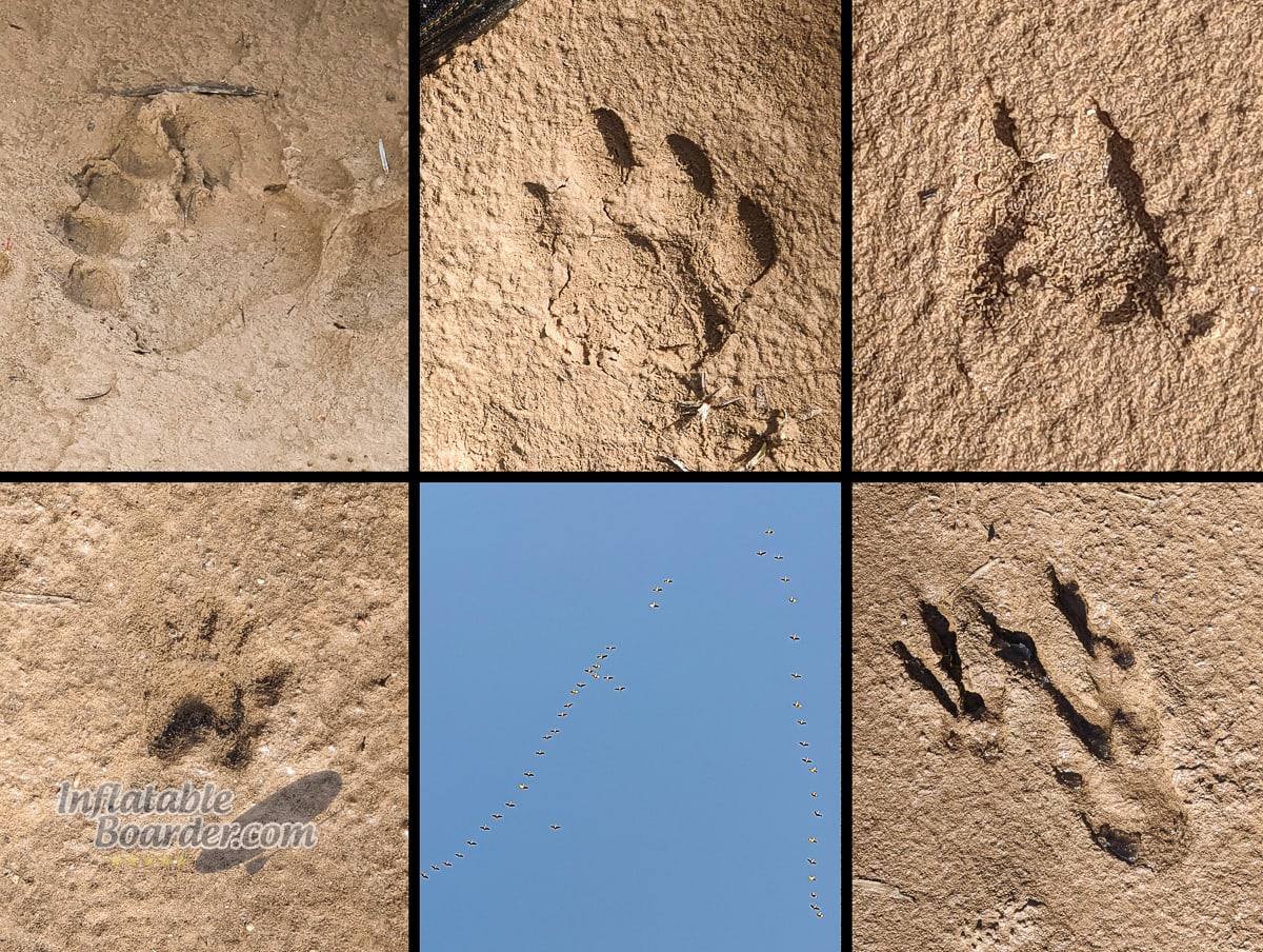
Trip Tracks! Clockwise from top left we saw: Black Bear, Mountain Lion, Mule Deer, Raccoon tracks, several flocks of Sandhill Cranes, and Great Blue Heron tracks.
Whitewater
The next few miles were fairly uneventful. More splashy water with the occasional larger set of waves around a sharp turn, a few tires to move and mark here and there, and then around river mile 5 things get a little spicier.
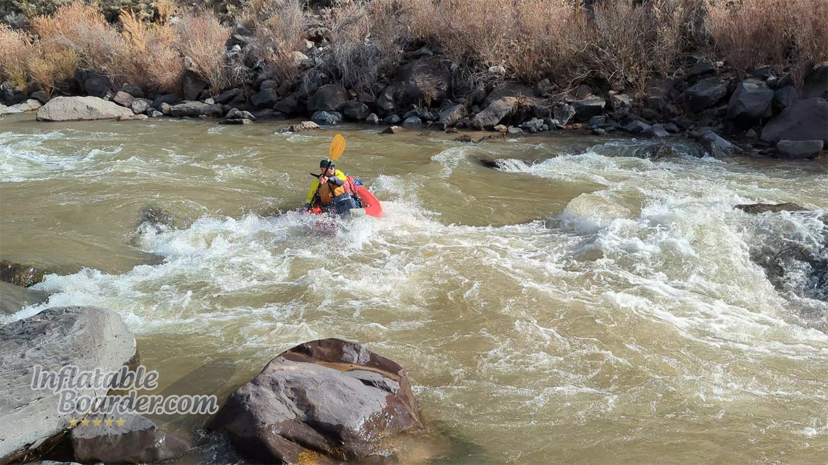
Miles 5-6 have more, larger whitewater as the canyon constricts, steepens, and large boulders from Water and Ancho Canyons make their way into the river. Just after mile 5 is Water Canyon Rapid. This is a proper Class II rapid with some decent-size waves (about 2 feet) with no “cheat” line around either side. Class II rapids are still easy to navigate with a very obvious path to follow that requires minimal maneuvering. When paddling over these types of waves, staggering your feet forward and backward and keeping a low stance with your paddle active in the water lets you easily adjust your weight and balance while using your knees as shock absorbers to go up and over the waves. The extra nose rocker on paddleboards like the Hydrus Joyride XL make it even easier to get up-and-over rather than plowing straight through the waves. Keeping the paddleboard up on top of the water makes it more stable and predictable, but plowing through the waves slows you down, weights the board, and reduces stability. With a little practice it’s easy to paddle over these types of rapids while staying on your feet.
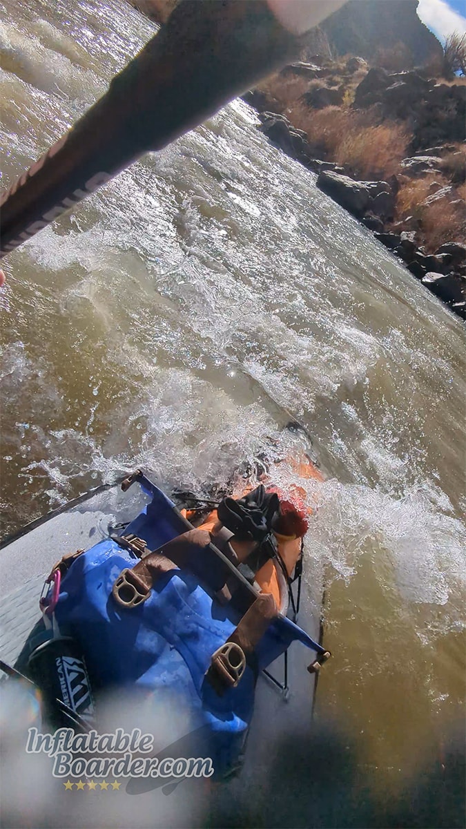
Class “Fun” splashy water made up about half of the first six miles of the trip.
About half a mile down river from Water Canyon Rapid is Ancho Rapid. Ancho Rapid is a Class III Rapid. There are two main differences between a Class II and Class III rapid. The first is wave size. A Class III rapid is defined as having waves large enough to swamp an open canoe. This typically means around 2.5’ at a minimum. The second major difference is that a Class III rapid will require some amount of maneuvering within the rapid itself. This means you need to have excellent situational awareness and boat control to know where you are and how to get where you need to be. There are also considerations for hazards, potential dangers if you flip, length, and more. With only 5 different river rapid classifications (6 if you count “unnavigable”) there is a lot of different variability within each class. While we were able to “read and run” Water Canyon Rapid with ease, half of us (including myself) hadn’t run this section before and wanted to scout Ancho Rapid to pick our best lines. This is a good habit to get into, regardless, as rivers constantly change and what was an easy rapid to navigate one day, may be impassable the next. Ancho Rapid at high water is also completely different, and becomes a Class IV rapid. At our water levels, it was a very manageable Class III.
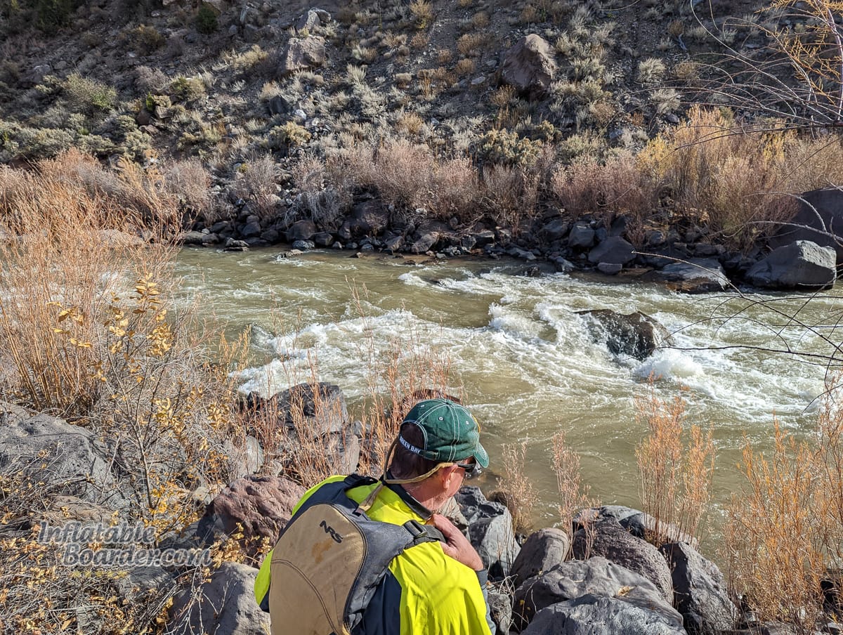
Scouting Ancho Rapid from River Right. This photo just shows the “crux” of the rapid.
There’s a lot of considerations and decision-making that goes into choosing the best route through a rapid. With Ancho the main line goes through the first two sets of wave trains in the middle of the river, and then you turn and paddle out of the main current to the right side of the river, behind a few “guard” rocks above the main pour-over (shown above). This lets you slip past the pour-over rock and have relatively clear-sailing through the rest of the rapid. Staying in the middle of the river and in the main current, will push you directly up and onto the pour-over rock where you’ll either flip over, get spun around one way or the other, or possibly stuck on the rock itself if you have the right speed and angle – none of which are ideal. Going to the far left side of the river is also possible, but requires you to pass over a barely-submerged rock (which would definitely hit your fin) and then still paddle back over to the right side before you go over another pour-over.

Satellite view showing the different obstacles and routes in Ancho Rapid.
I stayed up on my feet through the first wave train and into the second. In the second set of lateral waves I took a knee. Especially with a fully-loaded board, I’d rather stay on the board and easily make my turn from a half-kneeling position rather than get tossed off right above several large rocks. And it all worked according to plan! I made the turn between the guard rocks and the pour-over, and slipped down the right side of the river.
Because of how the river difficulty progresses through White Rock Canyon, I find it’s actually a really good place for newer whitewater paddlers to practice their skills. There’s plenty of warm up time on Class I/I+ before getting to the harder Water Canyon and Ancho Rapids. Both of which are very easy to stop before, scout, and even portage if you aren’t feeling up to running it that day.
A kayaker making the turn out of the main current between the guard rocks (left) and the large pour-over (right).
Getting to Camp
Almost immediately after Ancho Rapid the river completely calmed down to a fun, flat float. Between our slightly delayed start, stops for tires (and phone searching), and taking the time to scout Ancho Rapid, we set off with a bit more intention in our paddling as we knew we needed to find a campsite relatively soon.
As we paddled on we found neither suitable sandbars nor flat and open areas where we could pitch a few tents for the night. After the first few miles we knew we were going to have to make it all the way to Capulin Canyon at Mile 14 before we were going to stop for the day. As the sun was setting (and making it really hard to see through the glare) we spotted the wide, muddy beach at the mouth of Capulin Canyon and pulled in around 4:15pm. We covered 14 miles in 5 hours, including our various stops.
The landing was quite muddy, but the campsite was dry, flat, and open.
We set up our tents, changed out of our wet dry suits, and got the campfire going just as the last light of the day left. Everyone brought their own meals for this trip, and ranged from freshly-harvested Elk to Backpacker’s Pantry Blueberry Cheesecake, and everything in between. The air temperature dropped quickly, so I called it a night around 8 pm.
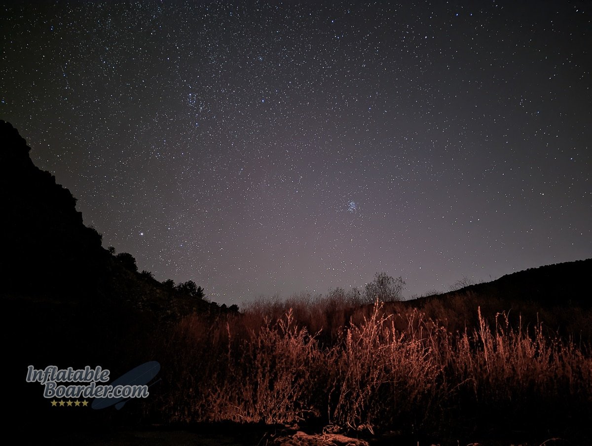
There’s nothing like the desert sky at night. The coyotes agreed.
That night the air temperature dropped to around 20° F. When I was much younger my scout troop would go camping every month, no matter the weather. In the Midwest, this meant learning to camp, and having the equipment to sleep safely, in the cold. The coldest trip I can recall had a low of -8° F. Now, I haven’t been in scouting for a number of years and I live in the southwest, so I’ve been letting myself get a little soft. For this trip I actually borrowed my wife’s 25° sleeping bag to use in addition to my 30° backpacking quilt and a silk liner. Mathematically I should be fine. But even with these extra layers working together (and dressed warm inside the sleeping bag), it’s just not the same as having a proper cold-weather sleeping bag. I didn’t sleep super well that night, but by going to bed early I was able to get enough sleep in the 12 hours before I got out of bed, that I woke up feeling reasonably well.
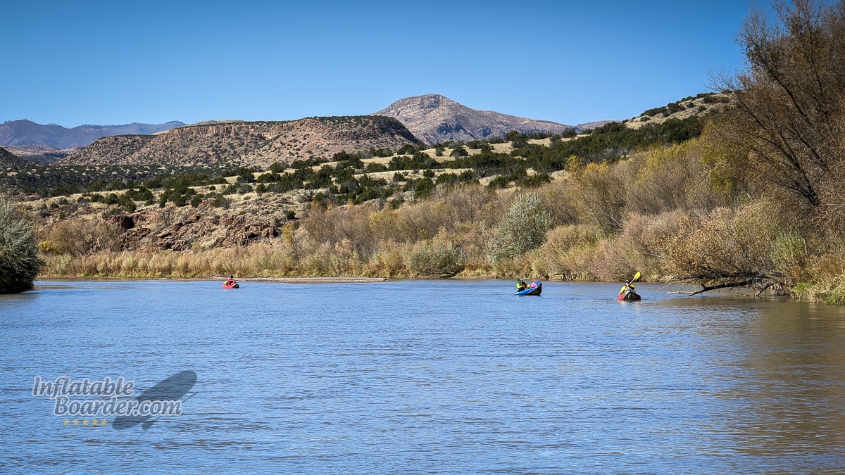
The second day was shallow-water route finding and paddling to the takeout on the lake.
Paddling Out
That morning we all woke up between 8-8:30 and took our time warming up by the fire, making breakfast, and repacking for the last leg of our trip. We also did a little bit of trail maintenance by removing some invasive vegetation around the campsite. I brought along a solar-powered pressure gauge and a small hand pump (a K-Pump Mini) to top off my paddleboard if needed in the morning. I started the trip at 20 PSI the day before, and at 10 am my board was still reading 18.5 PSI even with the temperature change. Good enough for me! A couple of the kayakers in the group did have to top-up their boats, though, as they run at much lower pressures. A change from 5 PSI to 3 PSI on an inflatable kayak makes a huge difference in how well it performs.
We got on the water at 11 am, and took off down river. Since this was a lower-water trip these last 4.5 river miles we chased the deeper, faster channels of water as they meandered across the river bed. This adds a good amount of time and distance to the paddle, and the speed of the current also slows down as the river bed widens. As the canyon opens up, the steep walls of basalt are fewer and farther between, but this also makes them easier to notice. The geologic history of this area is extensive and ranges from limestone formed by ancient seas, to the igneous basalt, tuff, and pumice from volcanic eruptions, and metamorphic granites and so much more brought up to the surface by mountainous rifts.
Giant columns of basalt are so commonplace in the upper part of the canyon you almost miss them, but they certainly stand out in the lower, wider section.
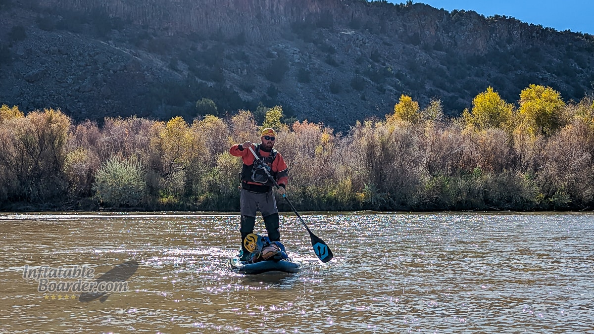
As White Rock Canyon widens and transforms into a more pastoral valley, the river slows and widens as it empties into Cochiti Lake. The current dies at the northernmost point of the lake, leaving us with a 1.3 mile flatwater paddle back to the boat ramp and parking lot where our cars were waiting. Thankfully, the wind remained calm and I was able to keep an easy 3 mph pace across the lake to make it back around 1 pm. While inflatable SUPs are normally considered to be slower than kayaks, that’s not always the case. The inflatable whitewater kayaks in use by the rest of the group are made for maneuverability, not speed, and I made landfall five minutes ahead of the first kayak, and nearly 30 minutes ahead of the last. Of course it’s not a race, but I’m always glad to help show off just how capable a paddleboard can really be!
In the final stretches before the Rio Grande becomes Cochiti Lake, White Rock Canyon gives way to rolling hills and mesas.
Final Thoughts
The Hydrus Joyride XL was the perfect paddleboard for this trip. I knew that I’d be able to easily pack everything I needed without losing any of the board’s excellent performance. The shorter gummy fin kept me headed where I wanted to go without dragging in the shallows – in fact I never had to step off while navigating the shallow, braided channels of the lower canyon, while the kayakers each took their turns walking their boats at one point or another! I also knew the Joyride XL’s construction and shape were up for the challenge presented by the whitewater portions of the trip. The stable shape and higher nose rocker kept the board moving up and over the waves with ease.
The rest of my gear did just as well – except for my sleeping system. I’ll definitely be upgrading that to something a bit warmer before taking another early winter camping trip. My dry suit was a little warm during the afternoons (especially on the lake), but it was so easy to cool down by hopping off the board, or even just dipping my legs into the water. On the flip side, my feet did get cold in the mornings, but I found that jumping up and down on the board was just the ticket to get my blood flowing through my toes and warm them right back up.
At higher flows, this section is easily done in a day. Well, easily done so long as the winds play nice in the afternoon! Now that I’ve done this trip, I can’t believe it’s taken me so long to do it. I’ll definitely be paddling White Rock Canyon again, though hopefully in some warmer temperatures! If you’re in the Santa Fe/Albuquerque area and looking for a beautiful section of river for a long day or comfortable overnight trip, I highly recommend White Rock Canyon.


Lisa says
I thoroughly enjoyed your recounting from such a fun and interesting adventure. I just started kayaking last summer and hope to explore more of New Mexico’s rivers and lakes.
Mike Carney says
Thanks! It’s a wonderful place to paddle.
jeff says
Great post and pictures. Thanks.